
Câmpofeni topographic map
Interactive map
Click on the map to display elevation.
About this map
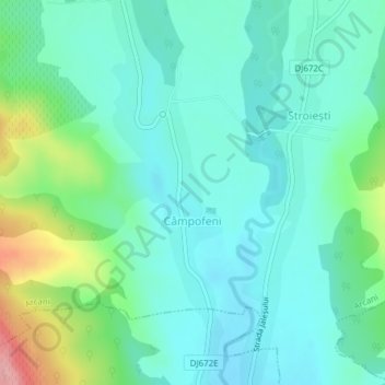
Name: Câmpofeni topographic map, elevation, terrain.
Location: Câmpofeni, Arcani, Gorj, 217026, Roumanie (45.05025 23.13639 45.06496 23.14435)
Average elevation: 237 m
Minimum elevation: 205 m
Maximum elevation: 338 m
Other topographic maps
Click on a map to view its topography, its elevation and its terrain.