Geolocate

Dhangadhi topographic map

Click on the map to display elevation.

About this map
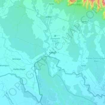
Name: Dhangadhi topographic map, elevation, terrain.

Location: Dhangadhi, Kailali, Sudurpashchim Province, Nepal (28.54330 80.40702 28.86330 80.72702)

Average elevation: 193 m

Minimum elevation: 156 m

Maximum elevation: 951 m

Other topographic maps

Click on a map to view its topography, its elevation and its terrain.

Chure

Nepal > Sudurpashchim Province > Kailali

Average elevation: 939 m

Bhajani

Nepal > Sudurpashchim Province > Kailali

Average elevation: 152 m

Bhajani

Nepal > Sudurpashchim Province > Kailali

Average elevation: 152 m

Gear up for your next adventure:

🥾Waterproof Hiking Boots - Essential footwear for rugged terrain and wet Canadian trails
🧊Insulated Water Bottle - Keeps drinks cold in summer and prevents freezing in winter
🧢Beanie Hat - Keep your head warm in cold weather
🧦Outdoor Socks - Durable socks designed for hiking and outdoor sports
💧Collapsible Water Bottle - Space-saving water bottle for outdoor activities

As an Amazon Associate, this site earns from qualifying purchases at no extra cost to you.