
Sungai Mersing topographic map
Interactive map
Click on the map to display elevation.
About this map
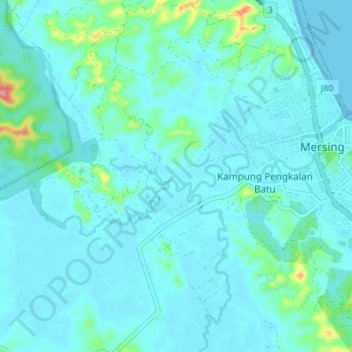
Name: Sungai Mersing topographic map, elevation, terrain.
Location: Sungai Mersing, Mersing, Johor, 86807, Malaysia (2.41267 103.77193 2.43568 103.83976)
Average elevation: 13 m
Minimum elevation: -1 m
Maximum elevation: 107 m
Other topographic maps
Click on a map to view its topography, its elevation and its terrain.
Kampung Air Merah
Kampung Air Merah, Mersing, Johor, 86800, Malaysia
Average elevation: 10 m
Kampung Seri Lalang Laut
Kampung Seri Lalang Laut, Mersing, Johor, 86800, Malaysia
Average elevation: 7 m
Sungai Jamari
Sungai Jamari, Mersing, Johor, Malaysia
Average elevation: 10 m