Geolocate

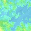
Ria d'Étel topographic map

Click on the map to display elevation.

About this map

Name: Ria d'Étel topographic map, elevation, terrain.

Location: Ria d'Étel, Plouhinec, Lorient, Morbihan, Bretagne, France métropolitaine, 56680, France (47.64232 -3.21880 47.75390 -3.10267)

Average elevation: 11 m

Minimum elevation: -2 m

Maximum elevation: 50 m

Other topographic maps

Click on a map to view its topography, its elevation and its terrain.
Keryvon

France > Bretagne > Morbihan > Plouhinec

Average elevation: 14 m

Bellevue

France > Bretagne > Morbihan > Plouhinec

Average elevation: 13 m

Mané Pillieu

France > Bretagne > Morbihan > Plouhinec > Mané Pillieu

Average elevation: 7 m

Kerychard

France > Bretagne > Morbihan > Plouhinec

Average elevation: 6 m

Le Pontoir

France > Bretagne > Morbihan > Plouhinec

Average elevation: 12 m

Guerno

France > Bretagne > Morbihan > Plouhinec > Guerno

Average elevation: 12 m

Mané Kerzine

France > Bretagne > Morbihan > Plouhinec

Average elevation: 8 m

Berringue

France > Bretagne > Morbihan > Plouhinec

Average elevation: 5 m

L’Hermitage

France > Bretagne > Morbihan > Plouhinec

Average elevation: 17 m

Nestadio

France > Bretagne > Morbihan > Plouhinec

Average elevation: 5 m

Lannic Gorée

France > Bretagne > Morbihan > Plouhinec

Average elevation: 11 m

Kerouzine

France > Bretagne > Morbihan > Plouhinec

Average elevation: 11 m

Gear up for your next adventure:

🔦LED Headtorch - Bright and durable light for night activities
🔥Camping Stove - Portable stoves to cook outdoors with ease
🧥Softshell Hiking Jacket - The perfect balance of wind protection and breathability
🥾Approach Shoes - Shoes designed for climbing approaches and rugged trails
🦟Insect Repellent - Keep mosquitoes and black flies away in wooded areas

As an Amazon Associate, this site earns from qualifying purchases at no extra cost to you.