
Thank you for supporting this site ❤️
Make a donation
Make a donation
Gear up for your next adventure:
As an Amazon Associate, this site earns from qualifying purchases at no extra cost to you.
Jageshwar topographic map
Click on the map to display elevation.
Thank you for supporting this site ❤️
Make a donation
Make a donation
Gear up for your next adventure:
As an Amazon Associate, this site earns from qualifying purchases at no extra cost to you.
About this map
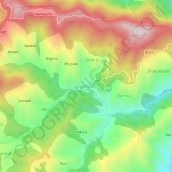
Name: Jageshwar topographic map, elevation, terrain.
Location: Jageshwar, Bhanoli, Almora, Uttarakhand, 263624, India (29.61837 79.83413 29.65837 79.87413)
Average elevation: 1,976 m
Minimum elevation: 1,661 m
Maximum elevation: 2,330 m
Thank you for supporting this site ❤️
Make a donation
Make a donation
Gear up for your next adventure:
As an Amazon Associate, this site earns from qualifying purchases at no extra cost to you.