Geolocate

Oued Taga topographic map

Click on the map to display elevation.

About this map

Name: Oued Taga topographic map, elevation, terrain.

Location: Oued Taga, Teniet El Abed district, Batna, 05000, Algeria (35.34359 6.21247 35.49547 6.54076)

Average elevation: 1,403 m

Minimum elevation: 944 m

Maximum elevation: 2,304 m

Other topographic maps

Click on a map to view its topography, its elevation and its terrain.
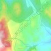
Bayou

Algeria > Batna > Teniet El Abed district > Oued Taga

Average elevation: 1,452 m

Sara

Algeria > Batna > Teniet El Abed district > Teniet El Abed

Average elevation: 1,834 m

Gear up for your next adventure:

🩹Moleskin Blister Pads - Direct protection for painful foot pressure points
🛌Insulated Sleeping Pad - Critical thermal barrier between you and the cold ground
🔋Lithium AA Batteries - Long-lasting power that performs in extreme cold
🥤Collapsible Travel Cup - Saves space and weight in your mess kit
⛺Tent Footprint - Protect tent floor and increase durability

As an Amazon Associate, this site earns from qualifying purchases at no extra cost to you.