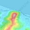
Aokas topographic map
Click on the map to display elevation.
Aokas
It is located at about 25 kilometres from the province's capital city of Bejaia. The commune of Aokas was created by decree of October 2, 1869. It covered an area of 2,202 hectares and had a population of 2,245 inhabitants in 1931. Its name in berber means shark. Its average altitude is 300 meters.
About this map

Name: Aokas topographic map, elevation, terrain.
Location: Aokas, Aokas District, Bejaia, 06007, Algeria (36.58666 5.19126 36.65039 5.28712)
Average elevation: 317 m
Minimum elevation: -2 m
Maximum elevation: 1,381 m
Other topographic maps
Click on a map to view its topography, its elevation and its terrain.