
Carmel topographic map
Click on the map to display elevation.
About this map
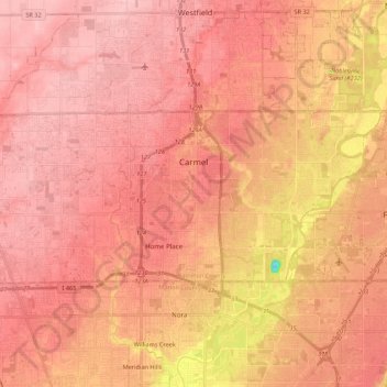
Name: Carmel topographic map, elevation, terrain.
Location: Carmel, Hamilton County, Indiana, United States (39.92604 -86.24107 40.00312 -86.02352)
Average elevation: 254 m
Minimum elevation: 153 m
Maximum elevation: 288 m
Other topographic maps
Click on a map to view its topography, its elevation and its terrain.