Geolocate

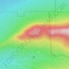
Newport topographic map

Click on the map to display elevation.

About this map

Name: Newport topographic map, elevation, terrain.

Location: Newport, Le Haut-Saint-François, Estrie, Quebec, J0B 3A0, Canada (45.30784 -71.55305 45.45995 -71.33931)

Average elevation: 389 m

Minimum elevation: 216 m

Maximum elevation: 579 m

Other topographic maps

Click on a map to view its topography, its elevation and its terrain.
Island Brook

Canada > Quebec > Le Haut-Saint-François > Newport

Average elevation: 340 m

Island Brook

Canada > Quebec > Le Haut-Saint-François > Newport

Average elevation: 340 m

Maple Leaf

Canada > Quebec > Le Haut-Saint-François > Newport

Average elevation: 379 m

Gould

Canada > Quebec > Le Haut-Saint-François > Lingwick

Average elevation: 322 m

Gear up for your next adventure:

🥾Trekking Poles - Adjustable trekking poles to reduce knee stress and improve stability
🧢Sun Hat - Wide-brim hat for sun protection
💧Hydration Bladder - Hands-free hydration solution for long treks
🩹Compact First Aid Kit - Pre-packed essentials for common trail injuries
💧Filtered Water Bottle - Safe drinking water on the go

As an Amazon Associate, this site earns from qualifying purchases at no extra cost to you.