Geolocate

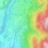
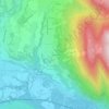
Lochieu topographic map

Click on the map to display elevation.

About this map

Name: Lochieu topographic map, elevation, terrain.

Location: Lochieu, Arvière-en-Valromey, Belley, Ain, Auvergne-Rhône-Alpes, France métropolitaine, 01260, France (45.91588 5.71264 45.94133 5.76856)

Average elevation: 859 m

Minimum elevation: 449 m

Maximum elevation: 1,498 m

Other topographic maps

Click on a map to view its topography, its elevation and its terrain.
Assin

France > Auvergne-Rhône-Alpes > Ain > Arvière-en-Valromey

Average elevation: 721 m

Gear up for your next adventure:

🕯️Camping Lantern - Illuminates your entire campsite with high-efficiency LEDs
🧭Orienteering Kit - Tools for map reading and navigation in the wild
🥤Collapsible Travel Cup - Saves space and weight in your mess kit
🥫Freeze-Dried Meals - Lightweight, high-calorie nutrition for multi-day treks
🧥Insulated Jacket - Keep warm in cold outdoor conditions

As an Amazon Associate, this site earns from qualifying purchases at no extra cost to you.