
Thank you for supporting this site ❤️
Make a donation
Make a donation
Gear up for your next adventure:
As an Amazon Associate, this site earns from qualifying purchases at no extra cost to you.
Koothpathri topographic map
Click on the map to display elevation.
Thank you for supporting this site ❤️
Make a donation
Make a donation
Gear up for your next adventure:
As an Amazon Associate, this site earns from qualifying purchases at no extra cost to you.
About this map
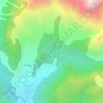
Name: Koothpathri topographic map, elevation, terrain.
Location: Koothpathri, Aru, Pahalgam, Anantnag, Jammu and Kashmir, India (34.08572 75.25390 34.12572 75.29390)
Average elevation: 2,981 m
Minimum elevation: 2,352 m
Maximum elevation: 4,261 m
Thank you for supporting this site ❤️
Make a donation
Make a donation
Gear up for your next adventure:
As an Amazon Associate, this site earns from qualifying purchases at no extra cost to you.