Geolocate

Pico Gamonal topographic map

Click on the map to display elevation.

About this map

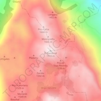
Name: Pico Gamonal topographic map, elevation, terrain.

Location: Pico Gamonal, Morcín, Asturias, 33118, España (43.22875 -5.94810 43.22885 -5.94800)

Average elevation: 1,440 m

Minimum elevation: 847 m

Maximum elevation: 1,692 m

Other topographic maps

Click on a map to view its topography, its elevation and its terrain.

Gear up for your next adventure:

🌡️Emergency Mylar Blankets - Compact thermal protection for unexpected nights outdoors
💡LED Camping Lantern - Illuminate your campsite with long-lasting lanterns
🧥Fleece Jacket - Warm and lightweight jacket for layering
🧊Portable Cooler - Keep food and drinks cold during outdoor adventures
🧳Compression Sacks - Maximize space in your backpack by shrinking gear

As an Amazon Associate, this site earns from qualifying purchases at no extra cost to you.