Geolocate

Boutlelis topographic map

Click on the map to display elevation.

About this map
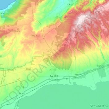
Name: Boutlelis topographic map, elevation, terrain.

Location: Boutlelis, Boutlelis District, Oran, 31000, Algeria (35.53798 -1.00697 35.67500 -0.79796)

Average elevation: 230 m

Minimum elevation: 0 m

Maximum elevation: 581 m

Gear up for your next adventure:

🔦LED Headtorch - Bright and durable light for night activities
🕶️Polarized Sunglasses - Reduces glare from snow and water at high elevations
🎒Hiking Backpack - Lightweight and ergonomic backpacks for day hikes or multi-day treks
🧊Insulated Water Bottle - Keeps drinks cold in summer and prevents freezing in winter
🧼Biodegradable Camp Soap - Environmentally friendly cleaning for gear and body

As an Amazon Associate, this site earns from qualifying purchases at no extra cost to you.