Geolocate

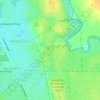
Buller topographic map

Click on the map to display elevation.

About this map

Name: Buller topographic map, elevation, terrain.

Location: Buller, Geraldton, Western Australia, Australia (-28.66785 114.60373 -28.63353 114.63651)

Average elevation: 36 m

Minimum elevation: 0 m

Maximum elevation: 94 m

Other topographic maps

Click on a map to view its topography, its elevation and its terrain.
Muir Park

Australia > Western Australia > Geraldton

Average elevation: 21 m

Gear up for your next adventure:

🧰Survival Kit - Essential gear for emergencies in the wilderness
🔭Compact Monocular - One-handed bird watching and trail spotting
🧼Travel Hand Sanitizer - Keep hands clean when water is scarce
🧥Ultralight Puffy Jacket - Maximum warmth that packs down to the size of an orange
🥾Waterproof Hiking Boots - Boots keeping your feet dry in wet conditions

As an Amazon Associate, this site earns from qualifying purchases at no extra cost to you.