Geolocate

Nashville topographic map

Click on the map to display elevation.

About this map

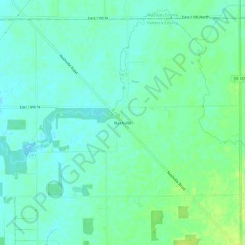
Name: Nashville topographic map, elevation, terrain.

Location: Nashville, Hancock County, Indiana, 46186, United States (39.90838 -85.67942 39.94838 -85.63942)

Average elevation: 289 m

Minimum elevation: 283 m

Maximum elevation: 298 m

Other topographic maps

Click on a map to view its topography, its elevation and its terrain.

Fortville

United States > Indiana > Hancock County

Average elevation: 263 m

Wilkinson

United States > Indiana > Hancock County

Average elevation: 307 m

Spring Lake

United States > Indiana > Hancock County

Average elevation: 259 m

New Palestine

United States > Indiana > Hancock County

Average elevation: 253 m

Cumberland

United States > Indiana > Hancock County

Average elevation: 261 m

Gear up for your next adventure:

🥾Waterproof Hiking Boots - Boots keeping your feet dry in wet conditions
Camping Tent - Weather-resistant tents suitable for 2 to 6 people
💡LED Headlamp - Hands-free illumination for night hiking and camping
🥾Mountain Hiking Boots - High-traction boots for rocky terrain
🪑Insulated Seat Pad - Protect your seat from cold rocks and wet logs

As an Amazon Associate, this site earns from qualifying purchases at no extra cost to you.