Geolocate

La Madera topographic map

Click on the map to display elevation.

About this map

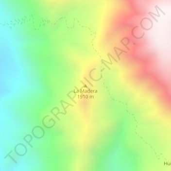
Name: La Madera topographic map, elevation, terrain.

Location: La Madera, Uruachi, Chihuahua, Mexico (27.77441 -108.67243 27.77451 -108.67233)

Average elevation: 1,680 m

Minimum elevation: 1,201 m

Maximum elevation: 2,298 m

Gear up for your next adventure:

🔥Camping Stove - Portable stoves to cook outdoors with ease
🥾Lightweight Hiking Boots - Boots for comfort and mobility on long hikes
🥾All-Terrain Hiking Boots - Versatile boots for varied hiking conditions
🥾Trail Running Boots - Durable shoes designed for trail running
🧥Waterproof Hiking Jacket - Protect yourself from rain and wind while hiking

As an Amazon Associate, this site earns from qualifying purchases at no extra cost to you.