Geolocate

Otzberg topographic map

Click on the map to display elevation.

About this map

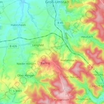
Name: Otzberg topographic map, elevation, terrain.

Location: Otzberg, Landkreis Darmstadt-Dieburg, Hesse, 64853, Germany (49.78701 8.84839 49.86972 8.96912)

Average elevation: 233 m

Minimum elevation: 149 m

Maximum elevation: 376 m

Other topographic maps

Click on a map to view its topography, its elevation and its terrain.

Gear up for your next adventure:

🚲Heavy Duty Bike Lock - Secure your bike at the trailhead or during stops
💡Compact LED Flashlight - Powerful and portable flashlight for outdoor use
🧦Outdoor Socks - Durable socks designed for hiking and outdoor sports
🕶️Polarized Sunglasses - Reduces glare from snow and water at high elevations
🥾Waterproof Hiking Shoes - Durable shoes for wet and rugged trails

As an Amazon Associate, this site earns from qualifying purchases at no extra cost to you.