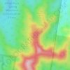
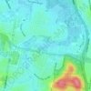
Mango Hill topographic map
Click on the map to display elevation.
About this map

Name: Mango Hill topographic map, elevation, terrain.
Location: Mango Hill, Brisbane, Queensland, 4509, Australia (-27.26470 153.01673 -27.21641 153.07943)
Average elevation: 9 m
Minimum elevation: -2 m
Maximum elevation: 36 m
Other topographic maps
Click on a map to view its topography, its elevation and its terrain.





Caboolture Region Environmental Education Centre
Australia > Queensland > Brisbane
Average elevation: 24 m