Geolocate

Aniban 1 topographic map

Click on the map to display elevation.

About this map

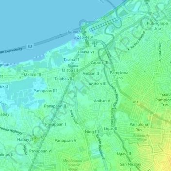
Name: Aniban 1 topographic map, elevation, terrain.

Location: Aniban 1, Bacoor, Cavite, Calabarzon, 4102, Philippines (14.43755 120.94296 14.47755 120.98296)

Average elevation: 7 m

Minimum elevation: -2 m

Maximum elevation: 21 m

Gear up for your next adventure:

🧴Insect Repellent - Protect yourself from bugs during outdoor adventures
🕶️Polarized Sunglasses - Protect your eyes with durable polarized lenses
🧰Survival Kit - Essential gear for emergencies in the wilderness
🧥Waterproof Jacket - Lightweight rain jackets for hiking and outdoor activities
🧤Thermal Hiking Gloves - Grip-enhanced gloves for cold-weather altitude trekking

As an Amazon Associate, this site earns from qualifying purchases at no extra cost to you.