Geolocate

Vauladray topographic map

Click on the map to display elevation.

About this map

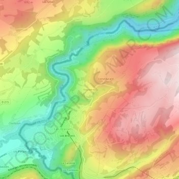
Name: Vauladray topographic map, elevation, terrain.

Location: Vauladray, Les Brenets, Le Locle, Neuchâtel, 2416, Suisse (47.05671 6.69455 47.09671 6.73455)

Average elevation: 944 m

Minimum elevation: 695 m

Maximum elevation: 1,189 m

Gear up for your next adventure:

💡LED Camping Lantern - Illuminate your campsite with long-lasting lanterns
🌬️Windproof Camp Stove - Efficient cooking even on exposed mountain peaks
🧣Evaporative Cooling Towel - Beat the heat during intense summer climbs
🎒Fully Waterproof Backpack - Total protection for photography gear and electronics
🧥Waterproof Hiking Jacket - Protect yourself from rain and wind while hiking

As an Amazon Associate, this site earns from qualifying purchases at no extra cost to you.