Geolocate

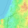
Bnei Brak topographic map

Click on the map to display elevation.

About this map

Name: Bnei Brak topographic map, elevation, terrain.

Location: Bnei Brak, Tel Aviv Subdistrict, Tel-Aviv District, Israel (32.06901 34.82143 32.10843 34.84929)

Average elevation: 33 m

Minimum elevation: 2 m

Maximum elevation: 81 m

Other topographic maps

Click on a map to view its topography, its elevation and its terrain.

Herzliya

Israel > Tel-Aviv District

Average elevation: 38 m

The Track Park

Israel > Tel-Aviv District > Tel Aviv

Average elevation: 15 m

Ayalon River

Israel > Tel-Aviv District > Tel Aviv

Average elevation: 23 m

Or Yehuda

Israel > Tel-Aviv District

Average elevation: 39 m

Herzliya

Israel > Tel-Aviv District

Average elevation: 38 m

Herzliya

Israel > Tel-Aviv District

Average elevation: 38 m

Gear up for your next adventure:

💡LED Camping Lantern - Illuminate your campsite with long-lasting lanterns
🧶550 Survival Paracord - Versatile utility cord for emergency repairs and rigging
🔥Emergency Fire Starter - Reliable ignition source for all weather conditions
🥾Trekking Boots - Durable boots for long-distance trekking
🔦LED Flashlight - Powerful and long-lasting flashlight for camping and emergencies

As an Amazon Associate, this site earns from qualifying purchases at no extra cost to you.