Geolocate

Engelsviken topographic map

Click on the map to display elevation.

About this map

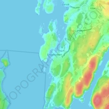
Name: Engelsviken topographic map, elevation, terrain.

Location: Engelsviken, Fredrikstad, Østfold, 1628, Norway (59.23272 10.71817 59.27272 10.75817)

Average elevation: 12 m

Minimum elevation: -1 m

Maximum elevation: 63 m

Gear up for your next adventure:

🧴Bear Spray Holster - Quick-access carry for essential Canadian wilderness safety
🥾Light Trekking Boots - Supportive boots for multi-day treks
🛏️Sleeping Bag - Warm and compact sleeping bags for outdoor camping
🎒Hiking Daypack - Lightweight and durable backpacks for day trips and excursions
🦶Anti-Blister Balm - Prevents friction and hotspots during long ascents

As an Amazon Associate, this site earns from qualifying purchases at no extra cost to you.