Geolocate

Rocca Chiarano topographic map

Click on the map to display elevation.

About this map

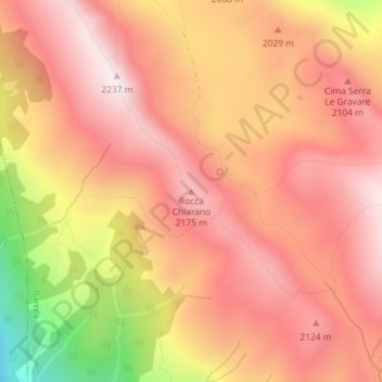
Name: Rocca Chiarano topographic map, elevation, terrain.

Location: Rocca Chiarano, Barrea, L'Aquila, Abruzzo, Italy (41.79869 13.97408 41.79879 13.97418)

Average elevation: 1,989 m

Minimum elevation: 1,485 m

Maximum elevation: 2,236 m

Gear up for your next adventure:

🥾Waterproof Hiking Shoes - Durable shoes for wet and rugged trails
🧥Ultralight Puffy Jacket - Maximum warmth that packs down to the size of an orange
📷Outdoor Action Camera - Capture high-elevation views and rugged adventures
🚲Bike Repair Kit - Essential tools for on-trail mechanical issues
🔭Compact Monocular - One-handed bird watching and trail spotting

As an Amazon Associate, this site earns from qualifying purchases at no extra cost to you.