Geolocate

Eagle Pass topographic map

Click on the map to display elevation.

About this map

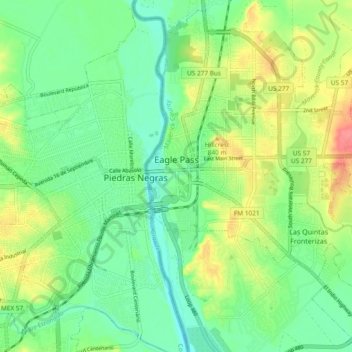
Name: Eagle Pass topographic map, elevation, terrain.

Location: Eagle Pass, Maverick County, Texas, 78852, United States (28.66333 -100.51175 28.74566 -100.42659)

Average elevation: 231 m

Minimum elevation: 205 m

Maximum elevation: 276 m

Other topographic maps

Click on a map to view its topography, its elevation and its terrain.

Eagle Pass

United States > Texas > Maverick County

Average elevation: 231 m

Gear up for your next adventure:

🥾Durable Hiking Shoes - Long-lasting shoes for frequent hiking
Lightweight Backpacking Tent - Compact tent for efficient hiking trips
💡Compact LED Flashlight - Powerful and portable flashlight for outdoor use
🥤Collapsible Travel Cup - Saves space and weight in your mess kit
🥾Light Hiking Boots - Lightweight and comfortable boots for day hikes

As an Amazon Associate, this site earns from qualifying purchases at no extra cost to you.