
Thank you for supporting this site ❤️
Make a donation
Make a donation
Gear up for your next adventure:
As an Amazon Associate, this site earns from qualifying purchases at no extra cost to you.
Karanodai topographic map
Click on the map to display elevation.
Thank you for supporting this site ❤️
Make a donation
Make a donation
Gear up for your next adventure:
As an Amazon Associate, this site earns from qualifying purchases at no extra cost to you.
About this map
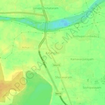
Name: Karanodai topographic map, elevation, terrain.
Location: Karanodai, Ponneri, Thiruvallur, Tamil Nadu, 600067, India (13.22810 80.13785 13.26810 80.17785)
Average elevation: 16 m
Minimum elevation: -9 m
Maximum elevation: 27 m
Thank you for supporting this site ❤️
Make a donation
Make a donation
Gear up for your next adventure:
As an Amazon Associate, this site earns from qualifying purchases at no extra cost to you.