Geolocate

Agumbe topographic map

Click on the map to display elevation.

About this map
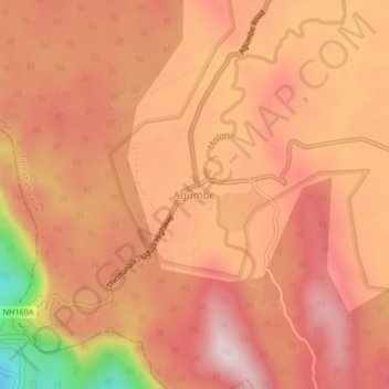
Name: Agumbe topographic map, elevation, terrain.

Location: Agumbe, Tirthahalli taluk, Shimoga, Karnataka, 577411, India (13.48848 75.07626 13.52848 75.11626)

Average elevation: 642 m

Minimum elevation: 214 m

Maximum elevation: 832 m

Gear up for your next adventure:

🥾Mountain Trail Shoes - High-traction shoes for mountain trails
🧢Outdoor Cap - Protective cap for sun and rain during hikes
🔋Emergency Crank Radio - Weather alerts and power without needing batteries
⛺Camping Tent - Weather-resistant tents suitable for 2 to 6 people
🥾Mountain Hiking Shoes - Shoes with superior grip for mountainous terrain

As an Amazon Associate, this site earns from qualifying purchases at no extra cost to you.