Geolocate

Sigra topographic map

Click on the map to display elevation.

About this map

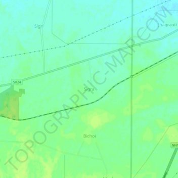
Name: Sigra topographic map, elevation, terrain.

Location: Sigra, Mahendragarh, Haryana, 123029, India (28.26543 76.16830 28.30543 76.20830)

Average elevation: 267 m

Minimum elevation: 260 m

Maximum elevation: 273 m

Gear up for your next adventure:

🧥Softshell Hiking Jacket - The perfect balance of wind protection and breathability
🧭Orienteering Kit - Tools for map reading and navigation in the wild
🐕Hiking Dog Pack - Let your canine companion carry their own water and food
🎒Hiking Daypack - Lightweight and durable backpacks for day trips and excursions
🏃Hydration Running Vest - Carry water and maps close to your body for speed

As an Amazon Associate, this site earns from qualifying purchases at no extra cost to you.