
Ile des Soeurs topographic map
Interactive map
Click on the map to display elevation.
About this map
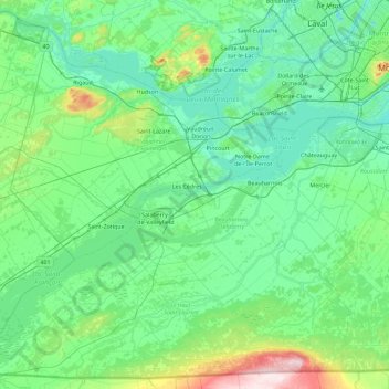
Name: Ile des Soeurs topographic map, elevation, terrain.
Average elevation: 58 m
Minimum elevation: 6 m
Maximum elevation: 344 m
Other topographic maps
Click on a map to view its topography, its elevation and its terrain.
Lac Saint-François
Canada > Québec > Salaberry-de-Valleyfield > Coteau-du-Lac
Lac Saint-François, Chemin de l'Île-aux-Chats, Salaberry-de-Valleyfield, Beauharnois-Salaberry, Montérégie, Québec, J6T 1B3, Canada
Average elevation: 45 m