Geolocate

Point topographic map

Click on the map to display elevation.

About this map

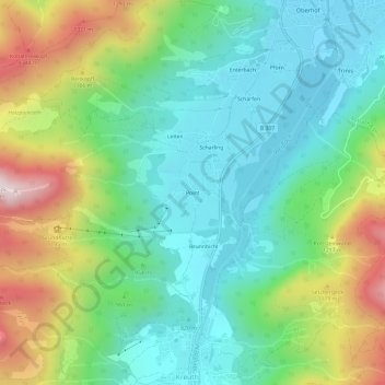
Name: Point topographic map, elevation, terrain.

Location: Point, Kreuth, Landkreis Miesbach, Bayern, 83708, Deutschland (47.64017 11.72507 47.68017 11.76507)

Average elevation: 973 m

Minimum elevation: 741 m

Maximum elevation: 1,471 m

Gear up for your next adventure:

🛁Quick-Dry Microfiber Towel - Space-saving towel that dries rapidly on the move
🏕️Camping Hammock - Integrated protection for sleeping between trees
Tent Footprint - Protect tent floor and increase durability
🔦LED Headtorch - Bright and durable light for night activities
🧢Outdoor Cap - Protective cap for sun and rain during hikes

As an Amazon Associate, this site earns from qualifying purchases at no extra cost to you.