Geolocate

Poggi topographic map

Click on the map to display elevation.

About this map

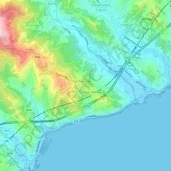
Name: Poggi topographic map, elevation, terrain.

Location: Poggi, Imperia, Provincia di Imperia, Liguria, 18017, Italy (43.85165 7.96260 43.89165 8.00260)

Average elevation: 70 m

Minimum elevation: -3 m

Maximum elevation: 324 m

Gear up for your next adventure:

🔨Vehicle Emergency Tool - Safety tool for remote road trips to trailheads
🪑Insulated Seat Pad - Protect your seat from cold rocks and wet logs
🔥Emergency Fire Starter - Reliable ignition source for all weather conditions
🧥Waterproof Jacket - Lightweight rain jackets for hiking and outdoor activities
🧭GPS Outdoor Watch - Smart watch for navigation and fitness tracking in nature

As an Amazon Associate, this site earns from qualifying purchases at no extra cost to you.