Geolocate

Lamuk topographic map

Click on the map to display elevation.

About this map

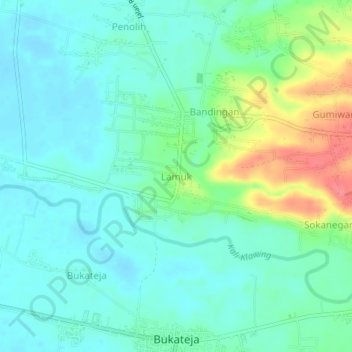
Name: Lamuk topographic map, elevation, terrain.

Location: Lamuk, Purbalingga, Central Java, Java, 53392, Indonesia (-7.43030 109.41356 -7.39030 109.45356)

Average elevation: 48 m

Minimum elevation: 28 m

Maximum elevation: 103 m

Other topographic maps

Click on a map to view its topography, its elevation and its terrain.

RT 04 RW 1

Indonesia > Central Java > Purbalingga > RT 04 RW 1

Average elevation: 1,213 m

Gear up for your next adventure:

🥾Hiking Gaiters - Protect legs and shoes from mud, snow, and debris
💡Compact LED Flashlight - Powerful and portable flashlight for outdoor use
👟Leg Gaiters - Keep debris, mud, and snow out of your boots
🦟Insect Repellent - Keep mosquitoes and black flies away in wooded areas
Backpacking Tent - Lightweight tent for long-distance hiking trips

As an Amazon Associate, this site earns from qualifying purchases at no extra cost to you.