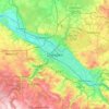
Innere Altstadt topographic map
Click on the map to display elevation.
Innere Altstadt
Dresden lies on both banks of the Elbe, mostly in the Dresden Basin, with the further reaches of the eastern Ore Mountains to the south, the steep slope of the Lusatian granitic crust to the north, and the Elbe Sandstone Mountains to the east at an altitude of about 113 metres (371 feet). Triebenberg is the highest point in Dresden at 384 metres (1,260 feet).
About this map

Name: Innere Altstadt topographic map, elevation, terrain.
Location: Innere Altstadt, Altstadt, Dresden, Saxony, Germany (51.04626 13.73071 51.05593 13.74714)
Average elevation: 117 m
Minimum elevation: 103 m
Maximum elevation: 137 m
Other topographic maps
Click on a map to view its topography, its elevation and its terrain.