Geolocate

Udgir topographic map

Click on the map to display elevation.

About this map

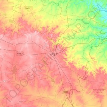
Name: Udgir topographic map, elevation, terrain.

Location: Udgir, Latur District, Maharashtra, 413517, India (18.23213 76.95961 18.55213 77.27961)

Average elevation: 572 m

Minimum elevation: 411 m

Maximum elevation: 693 m

Gear up for your next adventure:

🔋Solar Power Bank - Keep your GPS and devices charged during long outdoor trips
🗺️Topographic Maps - Detailed maps to explore trails, mountains, and wilderness areas
🥾Trail Hiking Shoes - Durable shoes designed for rugged trails
🥾Light Hiking Boots - Lightweight and comfortable boots for day hikes
🧤Rechargeable Heated Gloves - Extreme warmth for Canadian winter expeditions

As an Amazon Associate, this site earns from qualifying purchases at no extra cost to you.