Geolocate

Pianing topographic map

Click on the map to display elevation.

About this map

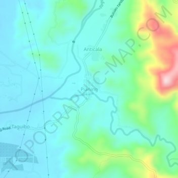
Name: Pianing topographic map, elevation, terrain.

Location: Pianing, Butuan, Caraga, Philippines (8.96654 125.62159 9.00654 125.66159)

Average elevation: 89 m

Minimum elevation: 16 m

Maximum elevation: 367 m

Gear up for your next adventure:

🧥Ultralight Puffy Jacket - Maximum warmth that packs down to the size of an orange
🛶Kayak Dry Bag - Waterproof storage for kayaking adventures
🌬️Windproof Camp Stove - Efficient cooking even on exposed mountain peaks
🎒Hiking Daypack - Lightweight and durable backpacks for day trips and excursions
🥾Trekking Poles - Adjustable trekking poles to reduce knee stress and improve stability

As an Amazon Associate, this site earns from qualifying purchases at no extra cost to you.