
Thank you for supporting this site ❤️
Make a donation
Make a donation
Gear up for your next adventure:
As an Amazon Associate, this site earns from qualifying purchases at no extra cost to you.
Mahapura topographic map
Click on the map to display elevation.
Thank you for supporting this site ❤️
Make a donation
Make a donation
Gear up for your next adventure:
As an Amazon Associate, this site earns from qualifying purchases at no extra cost to you.
About this map
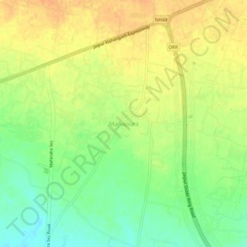
Name: Mahapura topographic map, elevation, terrain.
Location: Mahapura, Sanganer Tehsil, Jaipur, Rajasthan, 302013, India (26.82577 75.64841 26.86577 75.68841)
Average elevation: 391 m
Minimum elevation: 371 m
Maximum elevation: 407 m
Thank you for supporting this site ❤️
Make a donation
Make a donation
Gear up for your next adventure:
As an Amazon Associate, this site earns from qualifying purchases at no extra cost to you.