Geolocate

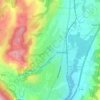
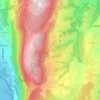
Braille topographic map

Click on the map to display elevation.

About this map

Name: Braille topographic map, elevation, terrain.

Location: Braille, Albens, Entrelacs, Chambéry, Savoie, Auvergne-Rhône-Alpes, France métropolitaine, 73410, France (45.78548 5.93394 45.82548 5.97394)

Average elevation: 402 m

Minimum elevation: 340 m

Maximum elevation: 558 m

Other topographic maps

Click on a map to view its topography, its elevation and its terrain.
Albens

France > Auvergne-Rhône-Alpes > Savoie > Entrelacs

Average elevation: 451 m

La Chambotte

France > Auvergne-Rhône-Alpes > Savoie > Entrelacs

Average elevation: 494 m

Épersy

France > Auvergne-Rhône-Alpes > Savoie > Entrelacs

Average elevation: 472 m

73410

France > Auvergne-Rhône-Alpes > Savoie > Entrelacs

Average elevation: 473 m

Saint-Girod

France > Auvergne-Rhône-Alpes > Savoie > Entrelacs

Average elevation: 432 m

Cessens

France > Auvergne-Rhône-Alpes > Savoie > Entrelacs

Average elevation: 621 m

Gear up for your next adventure:

🛁Quick-Dry Microfiber Towel - Space-saving towel that dries rapidly on the move
🦯Trekking Poles - Reduced impact on joints for steep topographic climbs
🧭GPS Outdoor Watch - Smart watch for navigation and fitness tracking in nature
🔨Vehicle Emergency Tool - Safety tool for remote road trips to trailheads
🪑Insulated Seat Pad - Protect your seat from cold rocks and wet logs

As an Amazon Associate, this site earns from qualifying purchases at no extra cost to you.