Geolocate

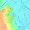
Ash Sheikh Zayed topographic map

Click on the map to display elevation.

About this map

Name: Ash Sheikh Zayed topographic map, elevation, terrain.

Location: Ash Sheikh Zayed, Aj Jiza, 12588, Egypt (29.88533 30.81975 30.20533 31.13975)

Average elevation: 105 m

Minimum elevation: 5 m

Maximum elevation: 264 m

Other topographic maps

Click on a map to view its topography, its elevation and its terrain.

Al Ayat City

Egypt > Aj Jiza

Average elevation: 23 m

Geziret el Dahab

Egypt > Aj Jiza > Giza

Average elevation: 23 m

Nazlet Al Siman and Al Sisi

Egypt > Aj Jiza > Giza

Average elevation: 42 m

Memphis

Egypt > Aj Jiza > Mit Rahinah

Average elevation: 23 m

Gear up for your next adventure:

🧴First Aid Kit - Essential first aid supplies for outdoor emergencies
🧢Beanie Hat - Keep your head warm in cold weather
🧶550 Survival Paracord - Versatile utility cord for emergency repairs and rigging
🔥Emergency Fire Starter - Reliable ignition source for all weather conditions
🎒Backpack Rain Cover - External shield to keep your entire pack dry

As an Amazon Associate, this site earns from qualifying purchases at no extra cost to you.