
Thank you for supporting this site ❤️
Make a donation
Make a donation
Gear up for your next adventure:
As an Amazon Associate, this site earns from qualifying purchases at no extra cost to you.
Temloul topographic map
Click on the map to display elevation.
Thank you for supporting this site ❤️
Make a donation
Make a donation
Gear up for your next adventure:
As an Amazon Associate, this site earns from qualifying purchases at no extra cost to you.
About this map
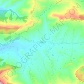
Name: Temloul topographic map, elevation, terrain.
Location: Temloul, Menaceur, Daïra Sidi Amar, Tipaza, Algérie (36.48199 2.13195 36.52199 2.17195)
Average elevation: 346 m
Minimum elevation: 231 m
Maximum elevation: 616 m
Thank you for supporting this site ❤️
Make a donation
Make a donation
Gear up for your next adventure:
As an Amazon Associate, this site earns from qualifying purchases at no extra cost to you.