Geolocate

Le Macle topographic map

Click on the map to display elevation.

About this map

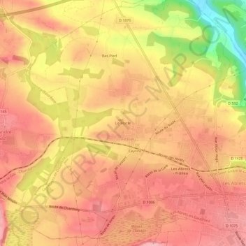
Name: Le Macle topographic map, elevation, terrain.

Location: Le Macle, Fitilieu, Les Abrets en Dauphiné, La Tour-du-Pin, Isère, Auvergne-Rhône-Alpes, France métropolitaine, 38490, France (45.52879 5.54215 45.56879 5.58215)

Average elevation: 375 m

Minimum elevation: 277 m

Maximum elevation: 420 m

Other topographic maps

Click on a map to view its topography, its elevation and its terrain.

Gear up for your next adventure:

🧥Thermal Layer - Insulating layer for cold outdoor conditions
🧢Hiking Sun Hat - Wide-brimmed protection for exposed mountain ridges
🔦LED Headtorch - Bright and durable light for night activities
❄️Traction Ice Cleats - Slip-on spikes for icy trails and winter hiking
🛰️Satellite Messenger - Emergency communication for areas with no cell service

As an Amazon Associate, this site earns from qualifying purchases at no extra cost to you.