Geolocate

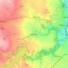
Hostivice topographic map

Click on the map to display elevation.

About this map

Name: Hostivice topographic map, elevation, terrain.

Location: Hostivice, okres Praha-západ, Central Bohemia, 253 01, Czechia (50.05826 14.19092 50.10347 14.29042)

Average elevation: 366 m

Minimum elevation: 309 m

Maximum elevation: 407 m

Other topographic maps

Click on a map to view its topography, its elevation and its terrain.
Talmberg Castle

Czechia > Central Bohemia > Talmberk

Average elevation: 405 m

Bylany

Czechia > Central Bohemia

Average elevation: 323 m

Břve

Czechia > Central Bohemia > Hostivice

Average elevation: 371 m

Mysletice

Czechia > Central Bohemia > Votice

Average elevation: 600 m

Tůmovka

Czechia > Central Bohemia > Předboj

Average elevation: 201 m

Gear up for your next adventure:

🧤Thermal Hiking Gloves - Grip-enhanced gloves for cold-weather altitude trekking
🥾Mountain Hiking Boots - High-traction boots for rocky terrain
❄️Traction Ice Cleats - Slip-on spikes for icy trails and winter hiking
🥾Hiking Shoes - Durable and comfortable shoes for trail hiking
🕯️Camping Lantern - Illuminates your entire campsite with high-efficiency LEDs

As an Amazon Associate, this site earns from qualifying purchases at no extra cost to you.