Geolocate

Bovini topographic map

Click on the map to display elevation.

About this map

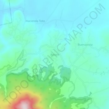
Name: Bovini topographic map, elevation, terrain.

Location: Bovini, Acambay de Ruíz Castañeda, State of Mexico, Mexico (19.98442 -99.82982 20.02442 -99.78982)

Average elevation: 2,726 m

Minimum elevation: 2,629 m

Maximum elevation: 3,137 m

Gear up for your next adventure:

🕶️Polarized Sunglasses - Protect your eyes with durable polarized lenses
🧥Waterproof Pants - Keep dry during rainy hiking conditions
🛶Canoe Life Vest - Safety vest for water sports
🧊Portable Cooler - Keep food and drinks cold during outdoor adventures
👖Convertible Hiking Pants - Zip-off legs to adapt to changing weather conditions

As an Amazon Associate, this site earns from qualifying purchases at no extra cost to you.