Geolocate

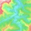
Pourcharesses topographic map

Click on the map to display elevation.

About this map

Name: Pourcharesses topographic map, elevation, terrain.

Location: Pourcharesses, Mende, Lozère, Occitania, Metropolitan France, 48800, France (44.38936 3.84516 44.49303 3.93581)

Average elevation: 855 m

Minimum elevation: 318 m

Maximum elevation: 1,674 m

Other topographic maps

Click on a map to view its topography, its elevation and its terrain.
Sauveplane

France > Occitania > Lozère

Average elevation: 463 m

Les Vanels

France > Occitania > Lozère > Vebron

Average elevation: 813 m

Le Coustat

France > Occitania > Lozère > Nasbinals

Average elevation: 1,202 m

Lespartis

France > Occitania > Lozère > Peyre en Aubrac > Aumont-Aubrac

Average elevation: 1,047 m

Gear up for your next adventure:

🚲Bike Repair Kit - Essential tools for on-trail mechanical issues
⛺Camping Essentials - All-in-one gear for a comfortable camping trip
💡LED Camping Lantern - Illuminate your campsite with long-lasting lanterns
💡Solar Camping Lamp - Eco-friendly lighting for campsites
🧢Hiking Hat - Sun-protective and breathable hats for long treks

As an Amazon Associate, this site earns from qualifying purchases at no extra cost to you.