
Thank you for supporting this site ❤️
Make a donation
Make a donation
Gear up for your next adventure:
As an Amazon Associate, this site earns from qualifying purchases at no extra cost to you.
Woodfin topographic map
Click on the map to display elevation.
Thank you for supporting this site ❤️
Make a donation
Make a donation
Gear up for your next adventure:
As an Amazon Associate, this site earns from qualifying purchases at no extra cost to you.
About this map
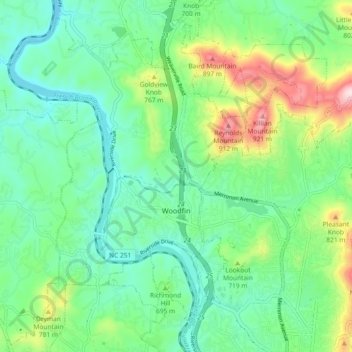
Name: Woodfin topographic map, elevation, terrain.
Location: Woodfin, Buncombe County, North Carolina, United States (35.60708 -82.63460 35.67440 -82.54281)
Average elevation: 673 m
Minimum elevation: 562 m
Maximum elevation: 960 m
Thank you for supporting this site ❤️
Make a donation
Make a donation
Gear up for your next adventure:
As an Amazon Associate, this site earns from qualifying purchases at no extra cost to you.
Other topographic maps
Click on a map to view its topography, its elevation and its terrain.
Arden
United States > North Carolina > Buncombe County > Asheville > Royal Pines
Average elevation: 693 m