Geolocate

Ramme topographic map

Click on the map to display elevation.

About this map

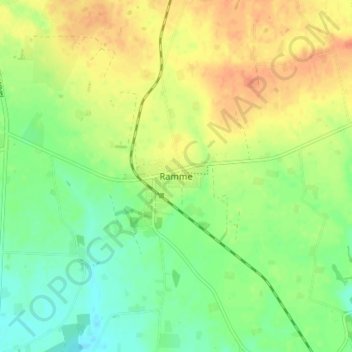
Name: Ramme topographic map, elevation, terrain.

Location: Ramme, Lemvig Municipality, Central Denmark Region, Denmark (56.47112 8.19357 56.51112 8.23357)

Average elevation: 23 m

Minimum elevation: 3 m

Maximum elevation: 43 m

Gear up for your next adventure:

🧥Thermal Layer - Insulating layer for cold outdoor conditions
🧣Merino Neck Gaiter - Protects against wind, sun, and cold at high altitudes
🥤Collapsible Travel Cup - Saves space and weight in your mess kit
🧣Evaporative Cooling Towel - Beat the heat during intense summer climbs
🧥Softshell Hiking Jacket - The perfect balance of wind protection and breathability

As an Amazon Associate, this site earns from qualifying purchases at no extra cost to you.