Geolocate

Comiso topographic map

Click on the map to display elevation.

About this map

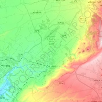
Name: Comiso topographic map, elevation, terrain.

Location: Comiso, Ragusa, Sicily, 97013, Italy (36.90225 14.52947 37.04060 14.64976)

Average elevation: 324 m

Minimum elevation: 39 m

Maximum elevation: 770 m

Gear up for your next adventure:

💧Reusable Water Bottle - Durable water bottles for hydration on trails
🧭GPS Tracker - Track your location in remote areas safely
🔪Outdoor Multitool - Versatile tool for repairs and food prep in the wild
👟Sport Hiking Sandals - Breathable footwear for water crossings and camp rest
🗺️Topographic Maps - Detailed maps to explore trails, mountains, and wilderness areas

As an Amazon Associate, this site earns from qualifying purchases at no extra cost to you.