Geolocate

Veghel topographic map

Click on the map to display elevation.

About this map

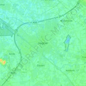
Name: Veghel topographic map, elevation, terrain.

Location: Veghel, Noord-Brabant, Nederland, 5461KN, Nederland (51.57346 5.50465 51.65346 5.58465)

Average elevation: 11 m

Minimum elevation: 5 m

Maximum elevation: 29 m

Gear up for your next adventure:

🥾Hiking Boots - Sturdy boots providing ankle support and traction on rugged trails
Camping Essentials - All-in-one gear for a comfortable camping trip
🥾Approach Boots - Comfortable boots for hiking and climbing approaches
🥾Light Hiking Boots - Lightweight and comfortable boots for day hikes
🥫Freeze-Dried Meals - Lightweight, high-calorie nutrition for multi-day treks

As an Amazon Associate, this site earns from qualifying purchases at no extra cost to you.