
Thank you for supporting this site ❤️
Make a donation
Make a donation
Gear up for your next adventure:
As an Amazon Associate, this site earns from qualifying purchases at no extra cost to you.
Guastella topographic map
Click on the map to display elevation.
Thank you for supporting this site ❤️
Make a donation
Make a donation
Gear up for your next adventure:
As an Amazon Associate, this site earns from qualifying purchases at no extra cost to you.
About this map
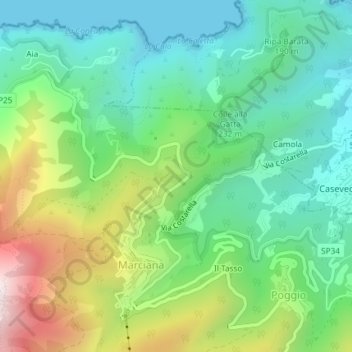
Name: Guastella topographic map, elevation, terrain.
Location: Guastella, Poggio, Marciana, Livorno, Toscana, 57033, Italia (42.78624 10.16221 42.80624 10.18221)
Average elevation: 252 m
Minimum elevation: 0 m
Maximum elevation: 790 m
Thank you for supporting this site ❤️
Make a donation
Make a donation
Gear up for your next adventure:
As an Amazon Associate, this site earns from qualifying purchases at no extra cost to you.