Geolocate

Baylanan topographic map

Click on the map to display elevation.

About this map

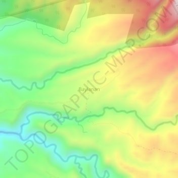
Name: Baylanan topographic map, elevation, terrain.

Location: Baylanan, Talakag, Bukidnon, Northern Mindanao, Philippines (8.05193 124.73087 8.09193 124.77087)

Average elevation: 1,206 m

Minimum elevation: 910 m

Maximum elevation: 1,571 m

Other topographic maps

Click on a map to view its topography, its elevation and its terrain.

Gear up for your next adventure:

🥾Trail Running Boots - Durable shoes designed for trail running
🥾Trail Hiking Boots - Supportive boots for rough trails
🛌Insulated Sleeping Pad - Critical thermal barrier between you and the cold ground
Bushcraft Tarp - Versatile emergency shelter or gear protection
🥾Hiking Shoes - Durable and comfortable shoes for trail hiking

As an Amazon Associate, this site earns from qualifying purchases at no extra cost to you.