Geolocate

Oiba topographic map

Click on the map to display elevation.

About this map

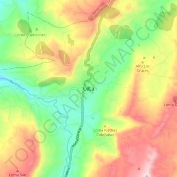
Name: Oiba topographic map, elevation, terrain.

Location: Oiba, Comunera, Santander, RAP Gran Santander, Colombia (6.22420 -73.33878 6.30420 -73.25878)

Average elevation: 1,569 m

Minimum elevation: 1,275 m

Maximum elevation: 1,937 m

Gear up for your next adventure:

🛌Insulated Sleeping Pad - Critical thermal barrier between you and the cold ground
🧥Thermal Layer - Insulating layer for cold outdoor conditions
🧼Biodegradable Camp Soap - Environmentally friendly cleaning for gear and body
🚲Bike Repair Kit - Essential tools for on-trail mechanical issues
🕶️Polarized Sunglasses - Reduces glare from snow and water at high elevations

As an Amazon Associate, this site earns from qualifying purchases at no extra cost to you.