
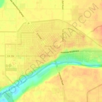
Waterford topographic map
Click on the map to display elevation.
Waterford
The city was founded around the Tuolumne River. City population signs report Waterford's elevation is 51 feet (16 m) above sea level.
About this map
Name: Waterford topographic map, elevation, terrain.
Location: Waterford, Stanislaus County, California, United States (37.62990 -120.77866 37.64962 -120.73859)
Average elevation: 49 m
Minimum elevation: 20 m
Maximum elevation: 61 m
Other topographic maps
Click on a map to view its topography, its elevation and its terrain.
San Joaquin River National Wildlife Refuge
United States > California > Stanislaus County
Average elevation: 14 m